Rewild
Nature
One Small Space
at a Time
Mother Tree Hub
feature
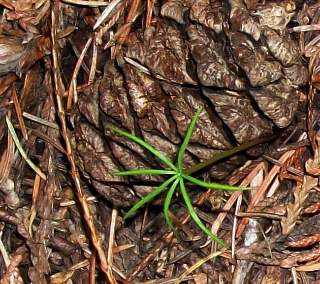
As you improve your skills at picking up feelings from plants and trees you will discover that plant energies within ecosystems gather into energy guilds. Often these guilds are strongest around Mother Trees. Like all plants, trees provide energy emissions, which also carry communication between themselves and others.
We really have a lot to learn about how everything works – and how everything is connected. Join us for a presentation about the importance of Mother Trees.
Library 1 – A Sense of Place
Geographic and geological information; natural history; plant and animal identification.
Geographical History of BC
Video from the Big BC Map, formerly located in the Royal BC Museum lobby.
Natural History of BC – Royal BC Museum Portal
The Okanagan watershed, or basin, is a narrow strip that spans from Armstrong to the US border and includes six main lakes – Okanagan, Kalamalka, Wood, Skaha, Vaseux and Osoyoos – and surrounding mountains. A river basin or watershed is high at its edges and low in the centre where the waters flow. The Okanagan Basin includes all the land that feeds water to our big lakes. Kelowna, Vernon, Penticton, and Osoyoos all lie within the Okanagan Basin.
The Okanagan Basin is almost 200 km in length and 8,000 km2 in area.
A short video on UBC’s Cluster of Research Excellence on Watershed Ecosystems. An interdisciplinary team of researchers and community partners assessing critical linkages and interactions in the Peachland watershed in the Okanagan. Dr. Wei is the cluster lead.
The Okanagan Basin Water Board at 50 - Bob Sanford
Bob Sandford is Global Water Futures Chair in Water & Climate Security at the United Nations University Institute for Water, Environment and Health. On Oct. 22, 2020, Bob joined us for an online presentation and dialogue, entitled "The Okanagan Basin Water Board: The Next 50 Years,” and provided insightful and inspiring commentary on where we've been, and suggestions on how we need to proceed to meet the challenges ahead. These challenges include climate change, political and social turmoil, and rapid population growth.
Geological History of the Okanagan
The geologic history of the Okanagan Valley began about 700 million years ago when the North American Plate separated from a much larger 2 billion year old continent and began drifting north westward, sliding over the heavier Pacific Plate. It was then located on the equator.
Identifying Rocks in BC
How can you tell what type of rock you have?
Okanagan Geologic History
A brief timeline of the geologic history of the main events that have shaped the south Okanagan as we can see it today.
Hiking the Aberdeen Columns
Okanagan Geology
Okanagan Bedrock Geology
Late Glacial History and Surficial Deposits of the Okanagan
Geology of the Penticton Tertiary Outlier in British Columbia http://www.empr.gov.bc.ca/Mining/Geoscience/PublicationsCatalogue/Maps/GeoscienceMaps/Pages/2002-5.aspx
Okanagan Basin Bedrock Geology
Okanagan Basin Water Board
Okanagan Basin Surficial Geology
Okanagan Basin Water Board
Geology, Okanagan Watershed, British Columbia
Geological Survey of Canada http://geoscan.nrcan.gc.ca/starweb/geoscan/servlet.starweb?path=geoscan/fulle.web&search1=R=292220
Geology of the southern Okanagan Valley shear zone
Unpublished field trip guide.
Detailed outcrop measured sections of the Eocene White Lake Formation, southern Okanagan Valley, British Columbia.
Geological Survey of Canada
Geohazards in the South Okanagan
UBC Okanagan
Geological map with mineral occurrences, fossil localities, radiometric ages and gravity field for southern British Columbia.
Geological Survey of Canada
Extension across the Eocene Okanagan crustal shear in southern British Columbia.
The Shuswap has a fascinating geological past, as below our feet is a section of a Precambrian craton called the Shuswap terrane, which is over two billion years old. Most of the rocks found in the Shuswap are metamorphic, including primarily schists, argillite, gneiss, and phyllite, formed from either igneous or sedimentary rock by heat and pressure. Plate tectonic processes created the mountains we see today. In addition to the mountains, these plate movements and earthquakes created folds and fault lines and many of these became distinct geological features.
Okanagan - Eagle River Fault System
Together with reconnaissance and local detailed mapping between Shuswap Lake and Adams Lake, this work has given insight into the distribution of strain related to what here is termed the Okanagan - Eagle River fault system, and has highlighted problems for future investigation into the nature of strain partitioning in detachment fault systems in general.
Learning about the rock types before you go rockhounding is easier than you think.
Primordial History
Like most major drainage basins of the Interior Plateau of southern British Columbia, the Nicola, Thompson, Shuswap and North Okanagan basins contained glacial lakes during the ice retreat that followed the Fraser Glaciation climax. The Nicola Basin was occupied by three glacial lakes: glacial Lake Quilchena which drained south, followed by glacial Lake Hamilton which drained east, and, finally, glacial Lake Merritt which drained north. The Thompson Basin contained glacial Lake Thompson and glacial Lake Deadman, both of which drained to the east. In the course of their history, these lakes stood at various levels that were controlled by the retreat of ice from a series of valleys leading to the Okanagan Valley.
The North Okanagan Basin was occupied by one main lake: glacial Lake Penticton. During the early deglaciation period, however, a small lake, separated by ice from the main lake, occupied the Coldstream Creek valley.
All stages of glacial Lake Penticton drained south, the level of each being controlled by dams of ice or debris and by isostatic tilting. Major glacial lakes formed in the Shuswap Basin: glacial Lake Thompson which was continuous with a glacial lake in the Thompson Basin, and glacial Lake Shuswap, several stages of which were continuous with glacial Lake Penticton in the North Okanagan Basin. Both these lakes drained into the Okanagan Valley. Deglaciation of the Interior Plateau was well advanced by 9.750 B. P. and by 8,900 B. P. all ice had melted and the glacial lakes had been drained.
The Okanagan escarpment, peaks and valleys were formed sometime between 9,000 and 11,000 years ago when glacier activity during the Pleistocene Epoch carved out what we now know as the Okanagan Valley. (Pleistocene Epoch was an age that began approximately 2.6 million years ago and is anachronistic with the most recent Ice Age, according to Kim Ann Zimmermann of Live Science)
The leftover grinded silt from the movement of the glaciers was eroded by Earthly elements and created the deltas in which Penticton, Kelowna and Vernon are now located. Beside them, the Swan, Kalamalka, Skaha, Vaseux and Osoyoos lakes
Glacial lake history, southern Interior Plateau, British Columbia
Geological Survey of Canada http://geoscan.nrcan.gc.ca/starweb/geoscan/servlet.starweb?path=geoscan/fulle.web&search1=R=106455
Late glacial history and surficial deposits of the Okanagan Valley, British Columbia
Okanagan Glacial Lakes
Professor Jerome Lesemann's glacial geology field trip near Okanagan Lake, British Columbia.
Biodiversity: Geological History in British Columbia
British Columbia Vegetation and Climate History
British Columbia Holocene vegetation and climate is reconstructed from pollen records. A coastal Pinus contorta paleobiome developed after glacier retreat under cool and probably dry climate. Cool moist forests involving Picea, Abies, Tsuga spp., and Pinus followed until the early Holocene. Pseudotsuga menziesii arrived and spread in the south 10 000-9000 BP, and Picea sitchensis - Tsuga heterophylla forests developed in the north. T. heterophylla increased 7500-7000 BP, and Cupressaceae expanded 5000-4000 BP. Bogs began to develop and expland. Modern vegetation arose 4000-2000 BP. There were early Holocene grass and Artemisia communities at mid-elevations and pine stands at high elevations in southern interior B.C. Forests expanded downslope and lakes formed 8500-7000 BP. Modern forests arose 4500-4000 BP while lower and upper tree lines declined. In northern B.C. non-arboreal communities preceded middle Holocene Picea forests. Abies, Pinus and Picea mariana predominated at various sites after 4000 BP. At 6000 BP Tsuga heterophylla (south) and Picea sitchensis (north) dominated the coast and islands and Quercus garryana and Pseudotsuga on southeast Vancouver Island, but Thuja plicata was infrequent. Southern Interior Plateau vegetation at 6000 BP was more open than today at middle to lower elevations, whereas forests covered the Northern Interior Plateau. Picea forests occurred in northern B.C. Holocene climate phases were: 1) warm dry "xerothermic" ca. 9500-7000 BP, 2) warm moist "mesothermic" ca. 7000-4500 BP, 3) moderate and moist 4500-0 BP, with increasing moisture 8500-6000 BP and cooling (?increased moisture) 4500-3000 BP. B.Cs Hypsithermal had dry and wet stages; 6000 BP occurred in the warm and wet mesothermic stage.
Paleontology and Geology of British Columbia
Pleistocene Salmon knock the glaciers back 6,000 years
An age of 18,000 plus years sets the fossils firmly as the only salmonids of the Late Pleistocene in North America, a very significant find. The date also changed our ideas about the early climate of the Interior; the Thompson Valley could not have been covered by glacial ice for as long as originally thought. Indeed, it makes the Interior ice-free only 2,000 years after the Last Glacial Maximum and some 4,000 years before our western continental coastline and the Rocky Mountain Foothills.
It has long been accepted that the most recent series of ice ages began approximately 1.6 million years ago, beginning as ice accumulations at higher altitudes with the gradual cooling of the climate. Four times the ice advanced and receded, most recently melting away somewhere around 10,000 years ago. Ice retreated from southwestern British Columbia and the Puget Sound area around 15,000 years ago.
In the southern Interior, ice built up first in the northern Selkirk Mountains, then slowly flowed down into the valleys. Once the valleys were filled, the depth of the ice increased until it began to climb to the highlands and finally covered most of the Interior of British Columbia. Between ice advances, there were times when the Kamloops area was ice free and the climate warm and hospitable.
Exotic Terranes of the Pacific Northwest
WU's Nick Zentner presents 'Exotic Terranes of the Pacific Northwest' - the 20th talk in his ongoing Downtown Geology Lecture Series. Recorded at Hal Holmes Center on February 21, 2018 in Ellensburg, Washington, USA.
Western Canada during the Mesozoic
The Mesozoic extends over 187 million years from the beginning of the Triassic (252 Ma) to the end of the Cretaceous (65 Ma). It was a particularly important period for the geology of western Canada. During this time, several continental collisions occurred along the west coast, resulting in the formation of the Rocky Mountains and the accretion (addition) of much of the land mass of British Columbia, and continuing deposition within the WCSB.
Eocene paleo-physiography and drainage directions, southern Interior Plateau, British Columbia
A map of reconstructed Eocene physiography and drainage directions is presented for the southern Interior Plateau region, British Columbia south of 53°N. Eocene landforms are inferred from the distribution and depositional paleoenvironment of Eocene rocks and from crosscutting relationships between regional-scale geomorphology and bedrock geology of known age.
Eocene drainage directions are inferred from physiography, relief, and base level elevations of the sub-Eocene unconformity and the documented distribution, provenance, and paleocurrents of early Cenozoic fluvial sediments. The Eocene landscape of the southern Interior Plateau resembled its modern counterpart, with highlands, plains, and deeply incised drainages, except regional drainage was to the north. An anabranching valley system trending west and northwest from Quesnel and Shuswap Highlands, across the Cariboo Plateau to the Fraser River valley, contained north-flowing streams from Eocene to early Quaternary time.
Other valleys dating back at least to Middle Eocene time include the North Thompson valley south of Clearwater, Thompson valley from Kamloops to Spences Bridge, the valley containing Nicola Lake, Bridge River valley, and Okanagan Lake valley. During the early Cenozoic, highlands existed where the Coast Mountains are today. Southward drainage along the modern Fraser, Chilcotin, and Thompson River valleys was established after the Late Miocene.
The Watersheds
The Okanagan Basin
The Okanagan watershed, or basin, is a narrow strip that spans from Armstrong to the US border and includes six main lakes – Okanagan, Kalamalka, Wood, Skaha, Vaseux and Osoyoos – and surrounding mountains. A river basin or watershed is high at its edges and low in the centre where the waters flow. The Okanagan Basin includes all the land that feeds water to our big lakes. Kelowna, Vernon, Penticton, and Osoyoos all lie within the Okanagan Basin. The Okanagan Basin is almost 200 km in length and 8,000 km2 in area.
The Okanagan River drains the lakes and flows south across the International Boundary as a small tributary to the Columbia River. Okanagan Basin water flows into the Columbia River, past the city of Portland, to the Pacific Ocean.
Shuswap Watershed Map
Biodiversity – Plants, Trees, Animals - Identification
E-Flora BC
This Identification Help Tool for vascular plants is a work-in-progress. It is being developed to help you identify vascular plants in BC (native or naturalized) by calling up a set of potential matching species. The tool searches content displayed in the E-Flora BC atlas pages, including the content of the Illustrated Flora of British Columbia (IFBC), so the search is based on terminology used in the atlas pages.
The BC Tree Book
Many of us who live in British Columbia appreciate its natural beauty - scenic landscapes, beautiful parks, and diverse plants and animals. When we visit different parts of our province, we encounter a diversity of climates and land forms. This diversity results in a tremendous variety of forest and plant communities. British Columbia has about 40 different species of native trees, but you won't find all of them everywhere you go. Some trees, like lodgepole pine, grow throughout the province, but others only grow in places where they are adapted to the particular climate. For example, western redcedar grows mostly on the coast and in the wetter palts of the Interior, where there is abundant rainfall and temperatures are mild. Englemann spruce grows at higher elevations, where winters are very cold and snowfall can be heavy. The information in tllls book will help you to identify the native trees in your neighbourhood and understand why they grow where they do. We hope that discovering the uniqueness of trees will be the first step to opening the door on the natural world, which also includes other plants, animals, insects and fungi - all part of the ecosystems of British Columbia. We hope the Tree Book will be just the beginning of your explorations.
E-Fauna BC
E-Fauna BC is a volunteer-driven, GIS-based biogeographic atlas of the wildlife of British Columbia that provides a centralized source of scientifically accurate information for use in conservation, education and research. Species covered range from mammals, birds, amphibians and fish to sea stars, sea cucumbers, insect and arachnids--and includes marine, freshwater and terrestrial species.
E-Fauna BC is part of a broader initiative on the biodiversity and biogeography of British Columbia, a 3-part project that provides documentation on the wild species and biodiversity of the province. This includes two comprehensive atlases (E-Flora BC and E-Fauna BC) and an umbrella website (Biodiversity of British Columbia) that introduces biodiversity concepts.
As a project built on volunteer geographic information (VGI), using citizen science, E-Fauna BC is the collaborative effort of many BC biologists and photographers who support our vision of creating an easily accessible centralized source of information on the wildlife of the province. Georeferenced photos contributed to the site are in effect voucher records for species occurrences. All records are verified before publication, ensuring a high level of data validity. This sort of VGI project, where citizens and experts work together to build knowledge, is at the forefront of data gathering to aid in biodiversity research and is part of a growing number of VGI projects across North America.
The Mother Tree Hub assists individuals with their efforts to dwell closer to nature and to develop enterprise that both rewilds nature and delivers ongoing regenerative stewardship.
The incubator interacts with the Wildcraft Forest School and Extension Services and contains both a residency program and an online program. Both programs seek to develop leadership within individuals and encourages small footprint lifestyle options while creating forms of social enterprise that links nature with agriculture, medicine and services which support a living Sanctuary Forest.
I
f you believe that you might benefit from the Mother Tree Hub and you are willing to expand your relationship with nature please contact us and we will set up a live conference call with you.
Contact our office by email at the Sanctuary Forest Network: services(at)sanctuaryforestnetwork.com
Or you can call the Wildcraft Forest on our direct line at:
250.547.2001
THE MOTHER TREE HUB - LIBRARY1
The Mother Tree Hub
An information portal produced by the Wildcraft Forest Foundation with support from the Regional District of the North Okanagan Conservation Fund; the David Suzuki Foundation and other community supporters.
The Wildcraft Forest Foundation offers skills, insights and
inspiration for creating good stewardship and positive change.
Located at the Wildcraft Forest
1981 Highway 6 Lumby, British Columbia
Discovery Centre – 250.547.2001 Email: services@sanctuaryforestnetwork.com
Main Website: www.wildcraftforest.com
Extension Services: www.wildcraftforestschool.com
Resource Centre: www.mothertreehub.com
This website and all material is copyrighted by the Wildcraft Forest Foundation
www.mothertreehub.com